19 December 2019
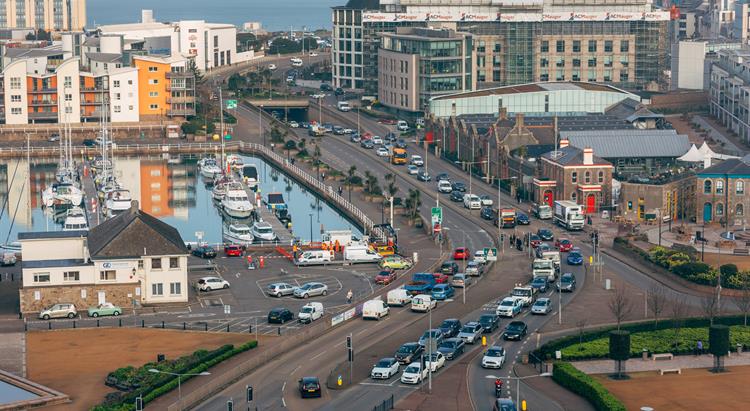
New planning guidance for the southwest of St Helier has been adopted by the Minister for Environment. It replaces the 2008 Esplanade Quarter Masterplan with immediate effect.
- covers a wider area
- provides a flexible development framework
- requires meaningful community engagement before any major planning applications are submitted
- supports improved connectivity between the area and the rest of St Helier
- is no longer based on the sinking of La Route de la Liberation, while improving the environment for cyclists and pedestrians and reducing the impact of vehicles
The Minister for Environment, Deputy John Young, said: “The St Helier Waterfront is an integral part of town and it’s essential that we adopt a ‘people first; buildings second’ approach to its future. I want to see a new and exciting phase of development which will strengthen the sense of community and vibrancy in this part of St Helier.
“I am encouraging a network of linked streets and spaces for everyone to enjoy, while also providing development opportunities that help meet the Island’s needs.
“This new planning framework will, though, require bold decisions. We will need to strike a balance between density and height of buildings; between competing land-uses; and between the demands of motor traffic and giving pedestrians and cyclists greater priority. These decisions should be community-led in line with the guiding principles of the framework.
“The new planning framework suggests different kinds of uses that I encourage the owners of disused or underused buildings to rejuvenate their properties to create a vibrant new area of St Helier.”
The Southwest St Helier Planning Framework replaces the 2008 Esplanade Quarter Masterplan which, for several years, has been considered out of date and inflexible by the independent planning inspectors who have reviewed it.
Work to update the existing planning guidance for the area from Jardins de la Mer to South Hill began in 2017 with community workshops. Several events were held to build relationships between individuals, community groups, key stakeholders and the Government, with the Design Council and the Commission for Architecture and the Build Environment acting as impartial facilitators.
The wide-ranging engagement led to the launch of a consultation on the Southwest St Helier Planning Framework in August. The feedback received during the nine-week public consultation was largely positive. In response to comments, the document was amended to remove as much jargon as possible and to emphasise the need to encourage eco-friendly, sustainable building materials and technologies in new developments.
Background
Our vision is for Southwest St Helier to be a place:
- with the community at its heart and where the community has helped shape its development
- with excellent open spaces and public realm
- where physical and cultural links between the sea and the town are reconnected
- where we all feel safe, and we feel we belong
- which we want to visit, and which has public amenities and activities that enliven the spaces
- where pedestrians and cyclists do not feel dominated or threatened by motor traffic
- where site planning has responded to, and is respectful of, the wider context of the townscape
- where high quality architecture relates to the local context
- to experience innovative and exciting ways to cross La Route de la Liberation. Given the context, an option might be to bridge La Route de la Liberation with a wide and attractive pedestrian / cyclist raised thoroughfare that also provides ease of access for the less mobile members of our community. The design of such a structure might be well suited to an international competition focused on design excellence.
 gov.je